Table of Contents
- Why Use a Drone for Real Estate Photography?
- Benefits of Drone Photography
- What to Think of When Taking Drone Photos
- What Are the Best Drones for Real Estate Photography?
- How Much to Charge for Drone Real Estate Photography?
- Edit Your Drone Real Estate Photography With PhotoUp!
Are you looking into how much to charge for drone real estate photography in 2026?
Drone photography has become increasingly popular in recent years as it provides a unique perspective on properties and their surrounding landscape. These images and videos can then be used to create virtual tours, promotional materials, and listings for real estate agents and property sellers.
In this post, we’ll share a ballpark of how much to charge for drone real estate photography in 2026. We’ll also cover the benefits of drone photography, what to think of when taking drone photos, and provide you with our list of the 4 best drones.
Why Use a Drone for Real Estate Photography?
Drone or aerial photography can be very useful in marketing and selling real estate for several reasons.
Before we talk about the benefits of drone photography, consider the following:
- 7 in 10 agents report that drone photography, videos, and virtual staging are more important since the start of the COVID-19 pandemic
- 83% of home sellers prefer to work with a real estate agent who uses drone photography
- 97% of home buyers used the internet to search for homes, and expect to see quality photos
Here are more powerful drone real estate statistics to consider:

As you can see, captivating images are a must to attract potential homebuyers, and offering real estate drone photography can also help you get more agent clients.
Benefits of Drone Photography


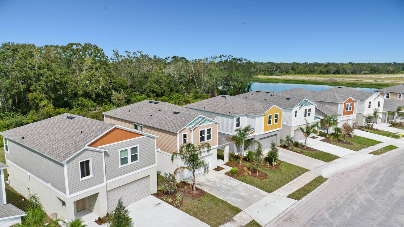
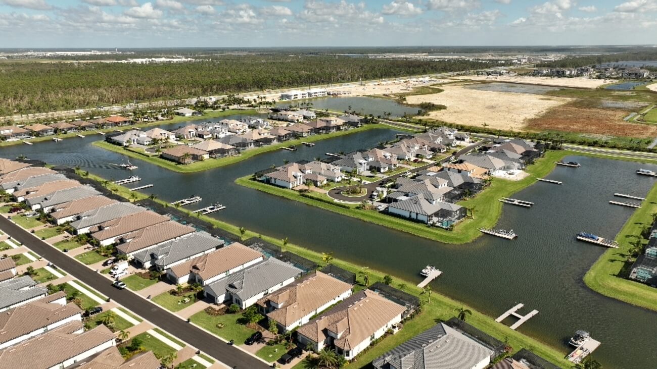
Drone photography can provide a unique perspective on a property and its surrounding area that isn’t possible with ground-based photography. This can help to showcase the property and its location more dynamically and attractively.
Additionally, drones can capture high-resolution images and videos that can be used to create virtual tours of a property, allowing potential buyers to get a detailed look at the space from the comfort of their own homes.
Here are a few more reasons why you should consider using a drone to shoot properties:
- Drones can help you capture images of difficult-to-access areas of a property, such as a roof, which can be useful for inspections or insurance purposes
- Aerial photography can be used to create 3D models of a property, which can be used for AI virtual staging, architectural design, and other purposes
- It can also be used to shoot large properties, like farms, ranches, or estates, where you need to showcase the extent and perimeter of the property
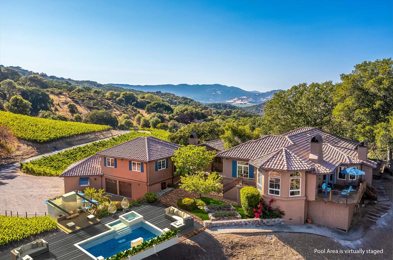
Overall, drone photography can be a valuable tool for real estate professionals as it can help showcase properties more dynamically and compellingly and provide valuable information to potential buyers.
What to Think of When Taking Drone Photos

When taking drone photos, there are several things to consider to ensure that you’re getting the best possible results:
| Plan your shoot: Before taking off, plan the flight path and angles of the drone, the best time of day to shoot the property, the weather conditions, etc. |
| Use the best lighting conditions: The lighting can make a big difference in the final outcome. Look for the best lighting conditions, like early morning or late afternoon light, which can produce nice and warm tones. Or dramatic shadows that can enhance the visual appeal of the images. |
| Consider the composition: Just like with traditional photography, it’s important to think about the composition of the shot and how you want to frame the property. Use the elements of design to guide your composition. For example, the rule of thirds, leading lines, foreground, middle ground, and background to create interesting and dynamic images. |
| Check the weather conditions: Be aware of the weather conditions and always keep an eye on the sky, especially if the clouds are moving in fast. Be prepared to quickly reschedule the shoot if necessary. |
| Be aware of the FAA regulations: Always abide by the regulations for flying drones, as per the FAA regulations. Make sure to be aware of the altitude and airspace restrictions, keep the drone in line-of-sight, and be aware of the restrictions in certain areas such as airports, national parks, etc. |
| Safety: Safety should be a top priority for both the operator and the people around. Make sure the drone is in good working condition, check for any malfunctions, and carry out a pre-flight check before taking off. |
By keeping these things in mind, you can help ensure that you are getting the best possible results when taking drone photos.
High-Quality & Consistent
Real Estate Photo Editing
Hire a dedicated editor with performance metrics from $7/hour.

What Are the Best Drones for Real Estate Photography?

Some drones are better and easier to operate when it comes to shooting properties. We recommend the following 4 drones that you can find on Amazon:
- DJI Mini 2 Fly More Combo – Ultralight Foldable Drone
- Flightelf Professional Sony Camera Drone
- DJI Mavic Air 2 – Drone Quadcopter UAV With 48MP Camera and 4K Video
- Ruko F11 Pro Drones With 4K UHD Camera
These drones have a flight time between 27 to 90 minutes and can shoot videos. They also have features such as GPS return to home, 50x zoom, obstacle avoidance technology, and 3-axis gimbal.
All in all, they are more than sufficient for real estate photographers who want to take high-quality aerial videos and images.
How Much to Charge for Drone Real Estate Photography?

The cost of drone real estate photography can vary depending on several factors, such as the size and location of the property, the complexity of the shoot, and the experience and equipment of the photographer.
Typically, professional drone photographers charge an hourly or daily rate for their services, which can range anywhere from $100 to $500 per hour, depending on their experience and the level of service they provide. Some photographers also charge per photo.
A full-day shoot can cost anywhere from $500 to $2500 or more, depending on the factors mentioned above.
Many drone pilots also charge based on square footage, with a photo package that includes both exterior and interior shots.
Here’s an example of a pricing structure per square footage:
| Under 2000 sq. ft. | $150 – $250 |
| Under 3000 sq. ft. | $250 – $350 |
| Under 4000 sq. ft. | $350 – $450 |
| Under 5000 sq. ft. | $450 – $650 |
On top of that, the cost of post-processing can also vary, depending on the level of editing required and the number of images to be processed. It can be anywhere from $50 to $200 per image.
It’s important to remember that while a lower price may seem appealing, it’s also important to consider the quality of the work and the experience of the photographer.
Investing in a professional drone photographer can help ensure that you are getting high-quality images that will help showcase your property in the best possible light.
It’s always recommended to ask for a portfolio, references, and insurance from the photographer to make sure you’re hiring a professional.
Lastly, it’s also a good idea to request quotes from multiple photographers and compare the cost and services offered before making a decision.
More Than Industry Leading
Real Estate Photo Editing
PhotoUp is the end-to-end business platform for real estate photographers.
Edit Your Drone Real Estate Photography With PhotoUp!


After capturing the images, post-processing is a must to make sure the final images are of good quality and ready to use. Color correction, white balance, exposure, and other adjustments can make a big difference in the final outcome.
Here’s where PhotoUp can help!
If you’ve already made the extra effort by using a drone, why not make sure your images are simply fantastic? Professional editing can make an average photo look impressive.
Apart from drone real estate photo editing, PhotoUp can also help with the following issues:
- Improper exposure levels
- Harsh shadows, lack of light, etc.
- Blurred images that were taken without a tripod
- Images that need cropping or other effects
- Lawn greening and sky replacements
- Twilight and day-to-dusk editing
- Clutter and advanced object removal
- Line and angle corrections
- And much more!
And it doesn’t stop there…
PhotoUp is a one-stop shop for all your real estate marketing needs and also offers additional services such as:
You’ll also get access to our user-friendly photo management system, so you can upload and receive photos, send instructions and feedback, track and manage team members and clients, store final images, and more!
PhotoUp Real Estate Photo Editing Uploader Demo
Check out how easy it is to get started with PhotoUp in our real estate photo editing uploader demo:
It’s really that easy! So what are you waiting for?
Sign up for a free PhotoUp account, and let us help take your drone real estate photography to the next level!
We hope this blog post helped you learn how much to charge for drone real estate photography in 2026. If you liked this article, you may also want to check out the following related resources: